ST_LUCAS QGIS Plugin#
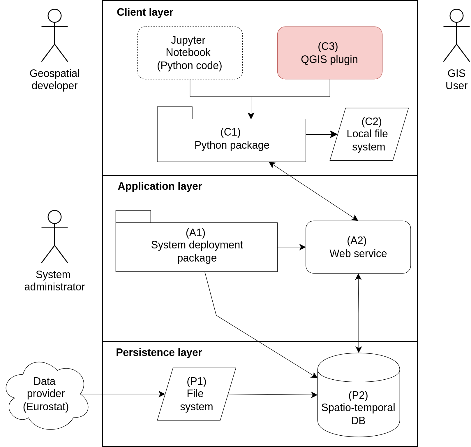
The plugin (ST_LUCAS Download Manager) allows to interactively select the spatial, attribute, temporal and thematic filters from the GUI. In particular, it allows selecting an area of interest (spatial filter) by the extent of the map canvas, specifying a country from a list of EU countries or using a user-defined vector polygon data layer. The plugin interface allows specifying also a list of selected years (temporal filter) and a group of attributes (thematic filter). The plugin also integrates functionality for performing a user-defined class aggregation using a JSON file, a nomenclature translation using a CSV file and showing photos of a selected LUCAS point.
The plugin consists of three tabs:
Known issues#
OWSLib library contains in versions 0.23-0.25 a critical bug, which affects this plugin. Please upgrade your OWSLib to version 0.26. Go to Plugins -> Python console and type:
import pip
pip.main(["install", "owslib>=0.26"])
and restart QGIS.