Download#
The first tab is used to download LUCAS points, where the user has to set individual parameters for downloading. Optionally, the user can download additional layers.
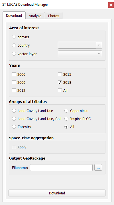
Area of interest#
In the first part, the user sets the area of interest. There are three options to choose from. If the user selects the canvas option, only LUCAS points that fall within the map window are downloaded.
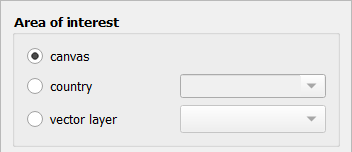
If the user selects the country option, a combo box will be available to select the countries for which LUCAS points will be downloaded. More than one country may be selected.
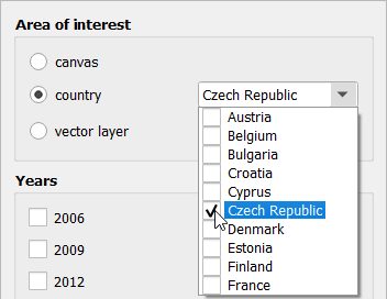
If the user selects the vector layer option, the plugin will allow the user to select a polygon layer loaded into QGIS as the area of interest for downloading LUCAS points.
Years#
The second part allows the user to select the years in which LUCAS points were measured. There are five years available: 2006, 2009, 2012, 2015 and 2018. More than one year may be selected. The user can also select the all option, which will return all years.

Note
Not all countries are available for all years. For example the year 2006 contains only 11 countries.
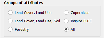
Groups of attributes#
In the third part, the user can choose which attributes in addition to the basic attributes will be included in the attribute table of downloaded LUCAS points. The user can choose all option, which returns all available attributes or one of the available groups of attributes can be selected. The following groups are available: Land Cover, Land Use; Land Cover, Land Use, Soil; Forestry; Copernicus; Inspire PLCC.
Space-time aggregation#
If more than one year has been selected, the user can decide whether to use space-time aggregation or not.

Additional layers#
In addition to the LUCAS points, the user can also download the corresponding representative areas related to each LUCAS point. The choices are calculated region-growing representative areas, Copernicus areas and observation circles. According to the checked years, the plugin automatically disables the selection of those additional layers that are not available for the given years.

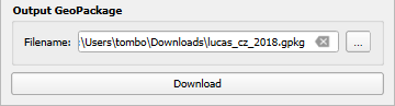
Output GeoPackage#
The last thing the user has to choose is where the geopackage with LUCAS points will be stored via tool button .... After this the LUCAS points can be downloaded by the Download button.
If the download was successful, information about the number of downloaded LUCAS points will be displayed as push message.

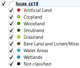
LUCAS points with predefined style corresponding with level 1 LUCAS nomenclature will be displayed in map window.
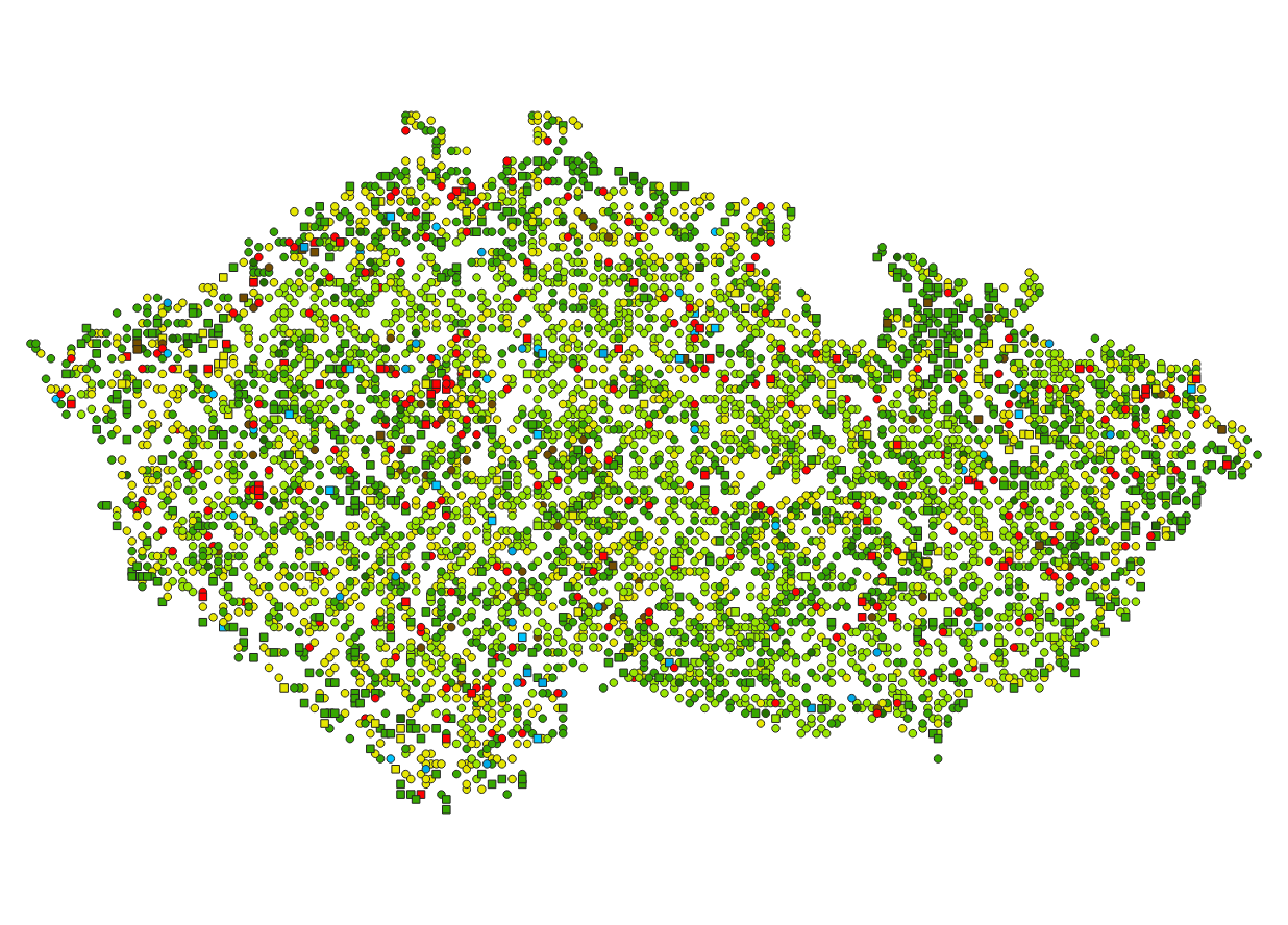
Level 1 nomenclature:
If the user has also checked some additional layers, the result will be one GeoPackage with multiple layers.

Note
LUCAS points with circle symbol indicate, that there are available photos of the LUCAS point. Square symbol means, that there are no photos available.
Note
In some cases it may be that there is no photograph of the point itself, but photographs of the cardinal directions are available. In such a situation, the point still has a square symbol, but the world direction photos can be displayed. For 2006, all points have a square symbol because it is not possible to determine from the attributes whether photos are available for a given point. (The necessary attributes have not yet been introduced for 2006.) However, this does not mean that the plugin is unable to display the available photos.
Note
If Space-time aggregation is checked, LUCAS points will be displayed with a different style that shows how many times each LUCAS point has been visited over the years. It is also good to keep in mind that space-time aggregated LUCAS points take a bit longer to download.
